
Points to Note for Rooftop Photovoltaic System Inspection
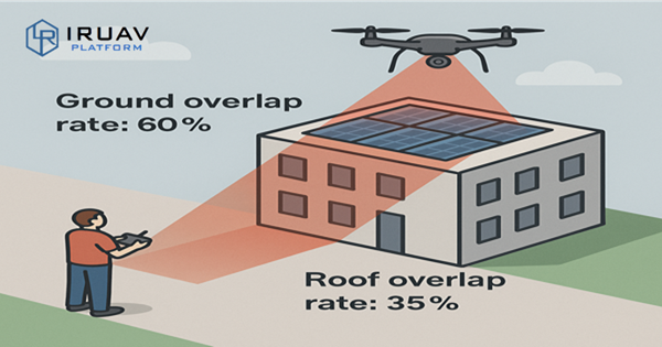
In recent years, most mainstream drone remote controllers come with built-in apps that support flight path planning. By using this function, visible light and thermal images of solar systems can be collected quickly and safely. When planning the flight path, in addition to the drone’s distance or altitude from the solar modules, the front and side overlap ratios are also key parameters. The overlap ratio in the app is typically calculated based on the takeoff altitude. However, when the drone takes off from the ground to inspect rooftop solar systems, the actual overlap ratio of the collected images will decrease (as shown in the figure). In such cases, it is necessary to increase the overlap ratio setting in the controller to prevent missing parts of the modules, which could make subsequent analysis difficult.